We, Aero Asahi Corp. (AAC), provide emergency medical services, flying cars, air mobility, surveying, aerial laser, and GIS services.


what we are~Brand Movie~

Services & Overseas Projects
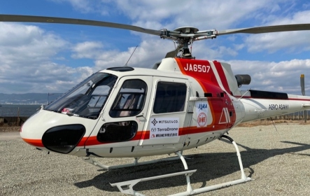
Aero Asahi Corp. (AAC) provides aviation services via helicopters and business jets as well as spatial information services mainly in the form of map information.
We are also engaged in international cooperation using the latest technology, primarily through ODA projects.


News
-

AERO ASAHI CORPORATION changing name to AERO TOYOTA from July 2025
-
English website renewal announcement
-
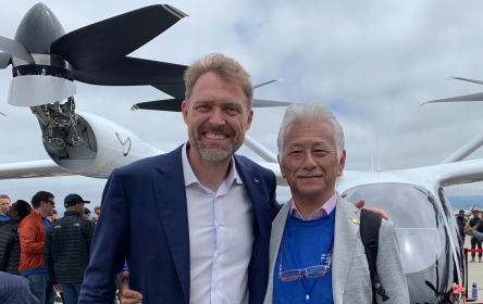
Aero Asahi's participation in the first aircraft roll off by Joby's
-

Aero Asahi and Joby Aviation partner to deliver shuttle service for TOYOTA
-
Demonstrated "Air Mobility Integrated Flight Management"platform business in Osaka
-
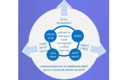
Our participation by Osaka Prefecture about their public offering project to realize "Flying Mobillity"