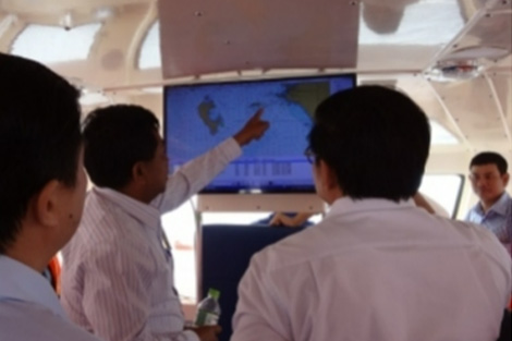
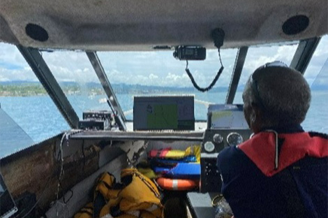
Electronic navigational charts, which can be called the car navigation system of the sea, contribute greatly to regional economic development as well as improving convenience for navigators, ensuring safe navigation and enhancing port credibility. Since 2012, amendments to the SOLAS Convention, which aims at ensuring maritime traffic safety, are gradually making it compulsory for ships to be equipped with Electronic Chart Display System (ECDIS). Due to a lack of hydrographic survey technology, however, developing countries have difficulty creating their own nautical charts.
We have extensive experience in conducting hydrographic surveys using multi-beam echo sounding and creating electronic navigational charts. Additionally, since electronic navigational charts need to be constantly updated with the latest information, we transfer the necessary technology to target countries so that they can update their own charts.
Overseas business | We, Aero Asahi Corp. (AAC), provide emergency medical services, flying cars, air mobility, surveying, aerial laser, and GIS services.
Overseas business

- Home
- Overseas business
For Japan,
For the World
Since launching our overseas operations with a topographic mapping in Laos in 1961,
we have carried out more than 200 overseas projects in more than 50 countries.
We are deploying our core and cutting-edge technologies, cultivated through domestic business operations,
overseas in the form of international cooperation, primarily through ODA projects.
we have carried out more than 200 overseas projects in more than 50 countries.
We are deploying our core and cutting-edge technologies, cultivated through domestic business operations,
overseas in the form of international cooperation, primarily through ODA projects.
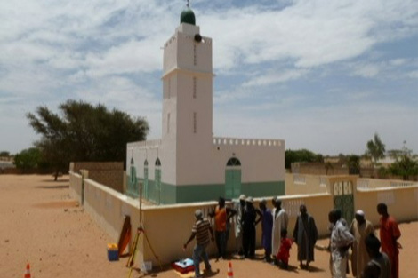
Nautical Chart Production
Principal Projects
| ・2022-2025 | JICA The Project for Development Support of Electronic Navigational Charts for Honiara and Noro Ports in Solomon Islands |
|---|---|
| ・2016-2023 | ASEAN/Malacca Straits Council Joint Hydrographic Survey of the Straits of Malacca and Singapore |
| ・2013-2017 | JICA Project for Productions of Integrated Digital Terrain Model and Electronic Navigational Chart in the Kingdom of Cambodia |
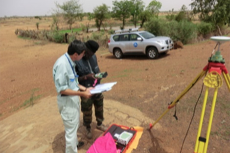
Map Making
Maps are commonly used in Japan, but even today there are many countries that do not have maps. There are various reasons for this, such as wanting to make maps but lacking the funds or technology to do so, or even if maps exist, they may be decades-old paper maps, or they may be under the control of the military and cannot be used freely. A lack of maps, however, often hinders a country’s development.
At AAC, based on over 50 years’ experience in creating maps and implementing GIS in overseas, we have developed a system for creating digital map data, integrating geographic information data and permanently updating map data. We have also provided a map distribution system using open source software.
In fact, maps and data that we provided are still used today in urban planning, disaster management and forest conservation, and the engineers that we trained have inherited our skills and are contributing to the development of their countries.
Principal Projects
| ・2022-2024 | Bhutan Gov. The Consulting Services for the Project for the Development of Digital Topographic Map |
|---|---|
| ・2012-2014 | JICA The Digital Topographic Mapping Project in Burkina Faso |
| ・2011-2013 | JICA The Digital Topographic Mapping for Northern Senegal |
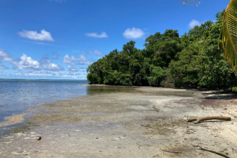
Environmental Issues
Environmental issues such as deforestation, soil degradation and marine environment conservation are major challenges for countries all over the world. At AAC, we use satellite remote sensing and GIS to provide survey services necessary for preparation of basic data and environmental conservation planning as a first step toward solving forest conservation and other environmental issues that affect countries. We will continue to contribute to achieving the Sustainable Development Goals (SDGs) adopted by the world through efforts to address environmental issues.
Principal Projects
| ・2022-2024 | JICA Project for Enhancement of Integrated Management of Coastal Ecosystem in Palau |
|---|---|
| ・2012-2016 | Nepal Gov. The Consulting Services for Procurement of Equipment for Forest Preservation |
| ・2012-2016 | Cote d'IvoireThe Consulting Services for Selection of Mapping for the Forest Preservation Programme |
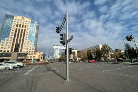
Infrastructure Management
The construction and maintenance of new infrastructure, domestically and internationally, presents both potential and challenges.
We also have experience in creating submarine topographic maps to support submarine laying construction (e.g., pipelines and cables). In addition, by utilizing measuring technologies using drones and MMS that we have cultivated both domestically and internationally, we provide spatial information technology to other countries to support infrastructure management of roads, railways, airports, power facilities, etc.
We also have experience in creating submarine topographic maps to support submarine laying construction (e.g., pipelines and cables). In addition, by utilizing measuring technologies using drones and MMS that we have cultivated both domestically and internationally, we provide spatial information technology to other countries to support infrastructure management of roads, railways, airports, power facilities, etc.
Principal Projects
| ・2022 | JICA SDGs Business Model Formulation Survey with the Private Sector for Effective Road Maintenance and Management System by ICT in Thailand |
|---|---|
| ・2016 | MLIT Project to improve the efficiency of transport infrastructure maintenence and management technology in Thailand |